


Increasing pressure is being placed on South Africans to respond to climate change and to reduce water demand in the face of being a water-scarce country. Fundamental to this, is information related to precipitation and seasonality of rainfall patterns. The precipitation map is now available online on the StepSA website for free use as part of a series of climate indicator maps.
For an interactive view of the indicator click here
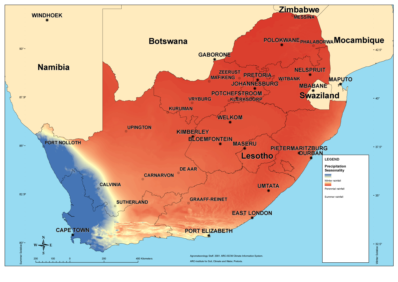
Winter rainfall areas, summer rainfall areas and perennial rainfall areas have been identified.
To design buildings that properly take climate into account it is important to know at what time of the year most of the precipitation occurs. Although the Köppen-Geiger map gives some indication of the seasonal precipitation it is not directly apparent because the seasonal factors are worked into the general formulae and therefore hidden for direct quantification.
Seasonal distribution of rainfall in South Africa was calculated by determining the ratio between quantities of the winter rainfall with the summer rainfall and then visualised in GIS, The highest ratio in the winter rainfall area was 6.85091. The lowest value in the summer rainfall area was 0.0735791. The former indicate that in the predominantly winter rainfall area the ratio of winter compared to summer rainfall is 6.85091. In the latter case the ratio indicates that in the most predominant summer rainfall area 13.590816 times as much rainfall occur in the summer compared to the winter. The perennial area is where the ratio value is 3.462245.
- CSIR Climate Map - Köppen-Geiger
- CSIR Climate Map - Aridity
- CSIR Climate Map - Heating degree day
- CSIR Climate Map - Cooling degree day
- CSIR Climate Map - Energy demand map
The climate data can be downloaded free of charge and is stored in an ESRI File Geodatabase format (note the file is provided in a zip-file):
| Climate data | |
Web Map Services allow you to display maps on your computer without the need to download the data. You can use these web services with free software such as Google Earth and ArcGIS Explorer, and with many different GIS software packages.
For more information contact:
Sheldon Bole,
sbole@csir.co.za