


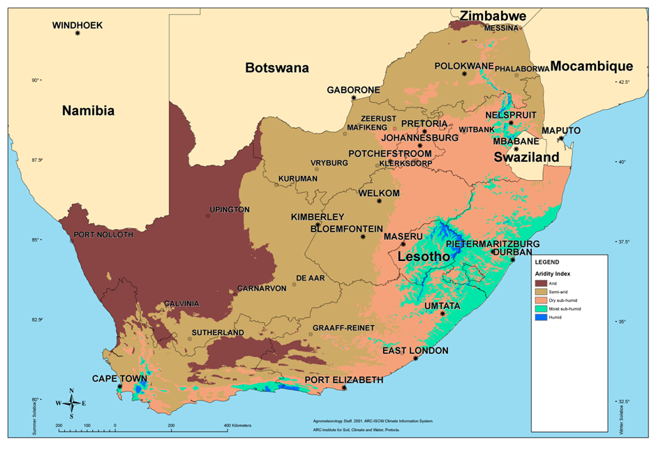
South Africa is a water scarce country. Key to building resilient settlements, guiding investment and design response is characterising aridity. The Aridity map is now available online on the StepSA website for free use as part of a series of climate indicator maps.
The De Martonne (1926) method was used for determining aridity index values for South Africa. Based on these values, the climate was zoned into six regions namely; arid, semi-arid, dry sub-h mid, moist sub-humid, humid and very humid.
 >
>
For an interactive view of the indicator click here
Alternatives to Martonne’s aridity index are Thornthwait’s precipitation effectiveness index and UNESCO aridity index model.
- CSIR Climate Map - Köppen-Geiger
- CSIR Climate Map - Precipitation
- CSIR Climate Map - Heating degree day
- CSIR Climate Map - Cooling degree day
- CSIR Climate Map - Energy demand map
The climate data can be downloaded free of charge and is stored in an ESRI File Geodatabase format (note the file is provided in a zip-file):
| Climate data | |
Web Map Services allow you to display maps on your computer without the need to download the data. You can use these web services with free software such as Google Earth and ArcGIS Explorer, and with many different GIS software packages.
For more information contact:
Sheldon Bole,
sbole@csir.co.za