


Strategic planning is a primary concern of service delivery at all levels and in all spheres of government. Strategic planning cannot be removed from place; in other words, how much of what is where; or what must be done where to establish improvement.
The accessibility/remoteness index was developed for in South Africa its entirety and it shows the proximity from any place in the country to higher order service centres. It measures the magnitude of the burden (measured in travel time in minutes by an average vehicle) to access a range of functions and services (public and private sector) as well as livelihood opportunities. In other words it is the level of access that a person living at any particular point in the country has to a range of services and other functions which are associated with an urban setting.
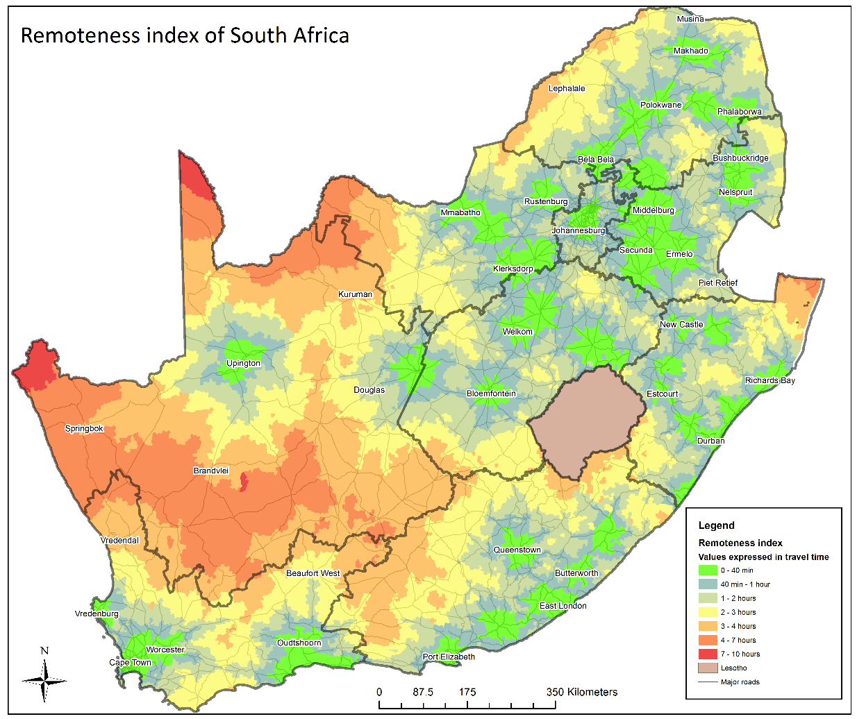
Bright green indicates very good access to urban functions and services while the orange to red indicates areas that have the worst access.
The accessibility/remoteness index was compiled by calculating the Cartesian distance from all places (i.e. each of the 25 000 mesozones) to the nearest village, small town, medium-sized town, large town and metropolitan area.
The following procedure was followed to calculate the remoteness index:
- Classification of all SA settlements into three categories based on the level of services and livelihood opportunities available in each settlement. The basis of this classification is the CSIR settlement typology.
- Measuring the geographic access (travel time) of all people in SA to all three levels of settlement types. This was done by using the CSIR mesozones as the analysis units and measuring the average travel time to its nearest settlement in each of the classes via the existing road network. Each mesozone is also attributed with the total population residing in it.
- Calculating a remoteness index for each mesozone based on the weighted average of the level of access (Cartesian distance) to urban functions and services.
Read more on the development here.
CSIR/SACN Functional Settlement Typology and Profiles
For more information contact:
Gerbrand Mans,
gmans@csir.co.za