


Settlements change over time and planning cannot be undertaken on the basis of total population alone. Cities and settlement requires efficiencies when considering infrastructure and service provision. Over or under utilisation of infrastructure or services is the result of too high or low population densities. Population density is calculated as the number of people per unit area - which in this case is hectare – and presented per sub-place. Change in density is measured by comparing the changes over time – the period used for comparison is 1996 to 2011.
This item considers the change in density within sub-places between two time periods. The density is calculated as people per hectare.
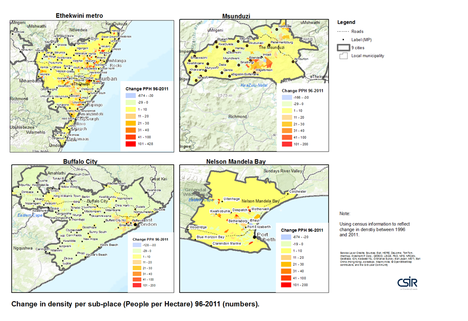
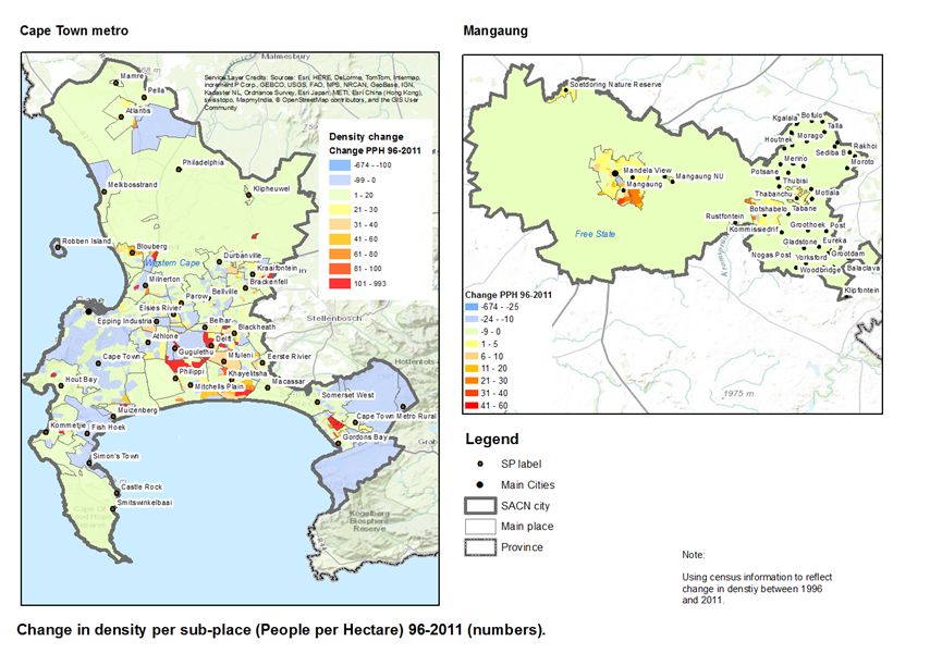
Most significant change (growth) in density has occurred in township areas as well as areas on the fringes of existing settlement areas. Limited higher densities can also be observed in central city areas (example Tshwane and Johannesburg). Older more established areas often show a decrease in density – this is however dependant on the city and its particular settlement dynamics.
In order to make comparison possible, it was necessary to relate the sub-place data for 1996 to the sub-places of 2011. The metadata document can be accessed here.
- CSIR BE. 2015. Indicator – Population change – density per Hectare per subplace 1996-2011. (Prepared in support of SACN – State of the Cities Report 2015).
- UN Habitat. 2011. The economic role of cities: The global urban economic dialogue series.
- SACN. 2011. Productive cities (Accessed on 29 Aug 2015 from http://sacitiesnetwork.co.za/productive_cities/)
For more information contact:
Johan Maritz,
jmaritz@csir.co.za