

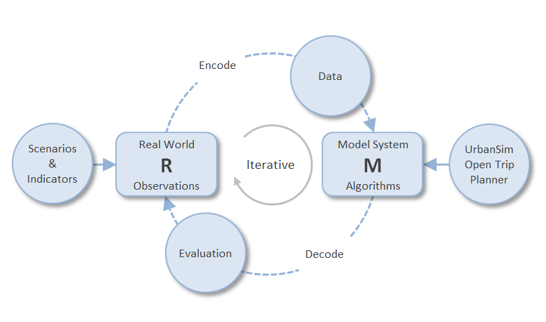
With reference to Figure 1 again, an important consideration in the quest for getting to the “most truthful representation“ of the real world system R in the model system M is the worldview that the modeller has of the real world system. UrbanSim of course was developed from a developed-world perspective. In a developing country like South Africa one typically finds a co-existence of a globally integrated 'formal economy' and a marginalised 'informal economy' reliant on subsistence activities. This not only challenges the underlying worldview of UrbanSim but also the source data.
In terms of worldview, UrbanSim for example models the interaction of households and businesses with the property market. This is primarily achieved by a variety of discrete choice models through which, for example, the probability of a business locating in an area is determined by examining the utility to the business of a number of alternative choices. The utility could be influenced by factors such as price, accessibility to highways, economics of agglomeration with similar businesses, etc. In the formal economy, a prerequisite for conducting a non-home-based business is to buy or rent floor space in an appropriate building. UrbanSim uses the occupancy rates of specific types of floor space as the feedback signal to determine whether new buildings of a specific type need to be built. In the informal economy there are no such prerequisites because business can be conducted on the street.
In terms of the source data, the recording of property transactions provides an important source of information that can be analysed to determine property values. In contrast, the informal economy is by definition unrecorded despite best efforts of the authorities to at least demarcate areas where such trading can take place.
It was the inherent adaptability of choice models that in 2009 offered the only hope that a model from the developed world would be able to describe the behaviour of shack dwellers in South Africa. In the end the factors that influence decisions differ but it remains a choice.
Disaggregation in a model, to represent the heterogeneity of the South African population was, and remains an important consideration.
As a pure micro-simulation model, UrbanSim does not have to aggregate properties of agents. Individual households, persons and jobs can be accommodated in as much detail as provided by sources such as STATSSA. A household can for instance be characterized by 11 income categories, 20 age categories and 4 population group categories. For improved comprehension and computational efficiency purposes a modeller may choose to use only 5 income categories, 5 age categories and 4 population group categories but none of this is imposed by UrbanSim.
The treatment of geography (which equates to the spatial resolution of the model) is flexible, providing a choice between grid cells, zones or cadastral parcels. Zones are user defined and could in the South African context be defined as a sub place, traffic analysis zone or any other statistical/planning/administrative unit. All of the CSIR’s work has thus far been based on cadastral parcels or a combination of parcels with identical properties to a maximum of one street block.
Equilibrium models are based on the assumption that interdependent model variables, such as prices and supply/demand adjust to equilibrium with zero delay or, if adjustment is delayed, equilibrium is eventually reached.
Dynamic models, on the other hand, are based on the assumption that changes in demand may be faster than the responses of supply, and that these differences in speed of adjustment are so significant that urban systems are normally in disequilibrium [Wegener (2004)].
In a review of three quasi-dynamic models (UrbanSim, DELTA and IRPUD) Wegener et al [2011] concluded: “The attraction of equilibrium as a concept is clear: it admits simple comparisons in an analytically elegant way. Unfortunately, urban regions are much more complex in their spatial patterns and temporal dynamics than can be represented in static equilibrium frameworks. While much remains to be done in further refining the dynamic approach to modelling urban regions, there is considerable evidence from the development and application of such models that they can both represent the essential dynamics of urban areas as reflected in longitudinal validation of such models, and that they can be used for applied policy analysis and planning. Urban regions are not static and should not be represented as such.”
Based on the substantial investment in human resources that is required to master sophisticated software like UrbanSim and to adapt it to succeed in South Africa, yet another consideration was that the model should have been successfully deployed in a number of cities and have established a sizeable user community.
At the time (2009) UrbanSim met this requirement and it has since grown by leaps and bounds. In the USA UrbanSim has been used in cities like Detroit, Honolulu, Houston, Phoenix, Salt Lake City, San Francisco, and Seattle. Outside the USA, UrbanSim has been utilised in Accra, Amsterdam, Beijing, Brussels, Paris, Rome, Seoul, Taipei, Tel Aviv, Turin and Zurich [Wray et al (2013) after Waddell, 2011]. In South Africa, the CSIR has since applied it in eThekwini, Nelson Mandela Bay and the City of Johannesburg, with the Cities of Tshwane and Ekurhuleni in progress. Worldwide UrbanSim is being used in a rapidly growing number of countries, including Argentina, Armenia, Australia, Austria, Belgium, Belize, Bolivia, Brazil, Cambodia, Cameroon, Canada, Chile, China, Czech Republic, Ecuador, Egypt, Ethiopia, France, Germany, Greece, Hong Kong, Hungary, India, Indonesia, Iran, Ireland, Israel, Italy, Jamaica, Japan, Jordan, Korea, Latvia, Lebanon, Lithuania, Luxembourg, Malaysia, Mexico, Moldavia, Morocco, Namibia, Netherlands, New Zealand, Nigeria, Oman, Pakistan, Philippines, Poland, Portugal, Russia, Saudi Arabia, Singapore, Slovenia, South Africa, Sri Lanka, Sweden, Switzerland, Taiwan, Thailand, Trinidad and Tobago, Turkey, Ukraine, United Arab Emirates, United Kingdom, USA, Venezuela, Vietnam [www.urbansim.org]. Without too many publications emanating from these countries one cannot judge to what extent these implementations have been successful enough to be adopted by the cities concerned.
The fact that UrbanSim is Open Source Software was an important consideration from the point of view that it was clear from the outset that the model would require some adaptation to succeed in South Africa. The extent of the adaptation was by no means clear but access to the source code provided the necessary “insurance”.
When the CSIR first set out to explore suitable models in 2007, the intention was to go well beyond LUT models by including a substantial environmental subsystem. From this perspective it was important that UrbanSim was part of the Open Platform for Urban Simulation (OPUS) designed not only to allow users to add their own models but to interface with other models. Interfacing with transportation modelling software such as EMME, VISUM and MATSim are commonplace.
In the end, only a limited number of changes had to be made to the UrbanSim source code but about five new models (uniquely South African) were developed within the OPUS framework for data preparation purposes (which are discussed next).
For more information contact:
Quinton van Heerden, CSIR
qvheerden@csir.co.za